


VTD-precinct 2, Sanborn County, South Dakota
About
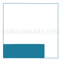
Outline

Summary
| Unique Area Identifier | 667762 |
| Name | VTD-precinct 2 |
| County | Sanborn County |
| State | South Dakota |
| Area (square miles) | 108.20 |
| Land Area (square miles) | 108.15 |
| Water Area (square miles) | 0.05 |
| % of Land Area | 99.95 |
| % of Water Area | 0.05 |
| Latitude of the Internal Point | 43.88734810 |
| Longtitude of the Internal Point | -98.14431660 |
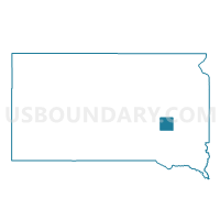
Maps

Graphs
Select a template below for downloading or customizing gragh for VTD-precinct 2, Sanborn County, South Dakota


Neighbors
Neighoring Voting District (by Name) Neighboring Voting District on the Map
- VTD - county precinct 1- Badger, Perry & N 1/2 of Mitchell twnships, Davison County, SD
- VTD - county precinct 2 - Baker, Union, Mt Vernon Twnships & Mt Vernon city, Davison County, SD
- VTD-precinct 1, Sanborn County, SD
- VTD-precinct 3, Sanborn County, SD
- VTD-precinct 4, Sanborn County, SD
- VTD-precinct 4, Jerauld County, SD
- VTD-precinct 6, Aurora County, SD
Top 10 Neighboring County Subdivision (by Population) Neighboring County Subdivision on the Map
- Perry township, Davison County, SD (287)
- Butler township, Sanborn County, SD (247)
- Letcher town, Sanborn County, SD (173)
- Badger township, Davison County, SD (170)
- Logan township, Sanborn County, SD (133)
- Letcher township, Sanborn County, SD (120)
- Elliott township, Sanborn County, SD (99)
- Blendon township, Davison County, SD (92)
- Belford township, Aurora County, SD (90)
- Twin Lake township, Sanborn County, SD (86)
Top 10 Neighboring Place (by Population) Neighboring Place on the Map
Top 10 Neighboring Unified School District (by Population) Neighboring Unified School District on the Map
- Mitchell School District 17-2, SD (18,417)
- Wessington Springs School District 36-2, SD (1,884)
- Plankinton School District 01-1, SD (1,281)
- Woonsocket School District 55-4, SD (1,217)
- Sanborn Central School District 55-5, SD (1,215)
- Mount Vernon School District 17-3, SD (998)
Top 10 Neighboring State Legislative District Lower Chamber (by Population) Neighboring State Legislative District Lower Chamber on the Map
- State House District 20, SD (22,214)
- State House District 22, SD (21,252)
- State House District 8, SD (20,647)
Top 10 Neighboring State Legislative District Upper Chamber (by Population) Neighboring State Legislative District Upper Chamber on the Map
- State Senate District 20, SD (22,214)
- State Senate District 22, SD (21,252)
- State Senate District 8, SD (20,647)
Top 10 Neighboring 111th Congressional District (by Population) Neighboring 111th Congressional District on the Map
Top 10 Neighboring Census Tract (by Population) Neighboring Census Tract on the Map
- Census Tract 9626, Davison County, SD (2,919)
- Census Tract 9736, Aurora County, SD (2,710)
- Census Tract 9621, Sanborn County, SD (2,355)
- Census Tract 9741, Jerauld County, SD (2,071)